U.S. Population Density Trends: County-Level Insights and Future Projections
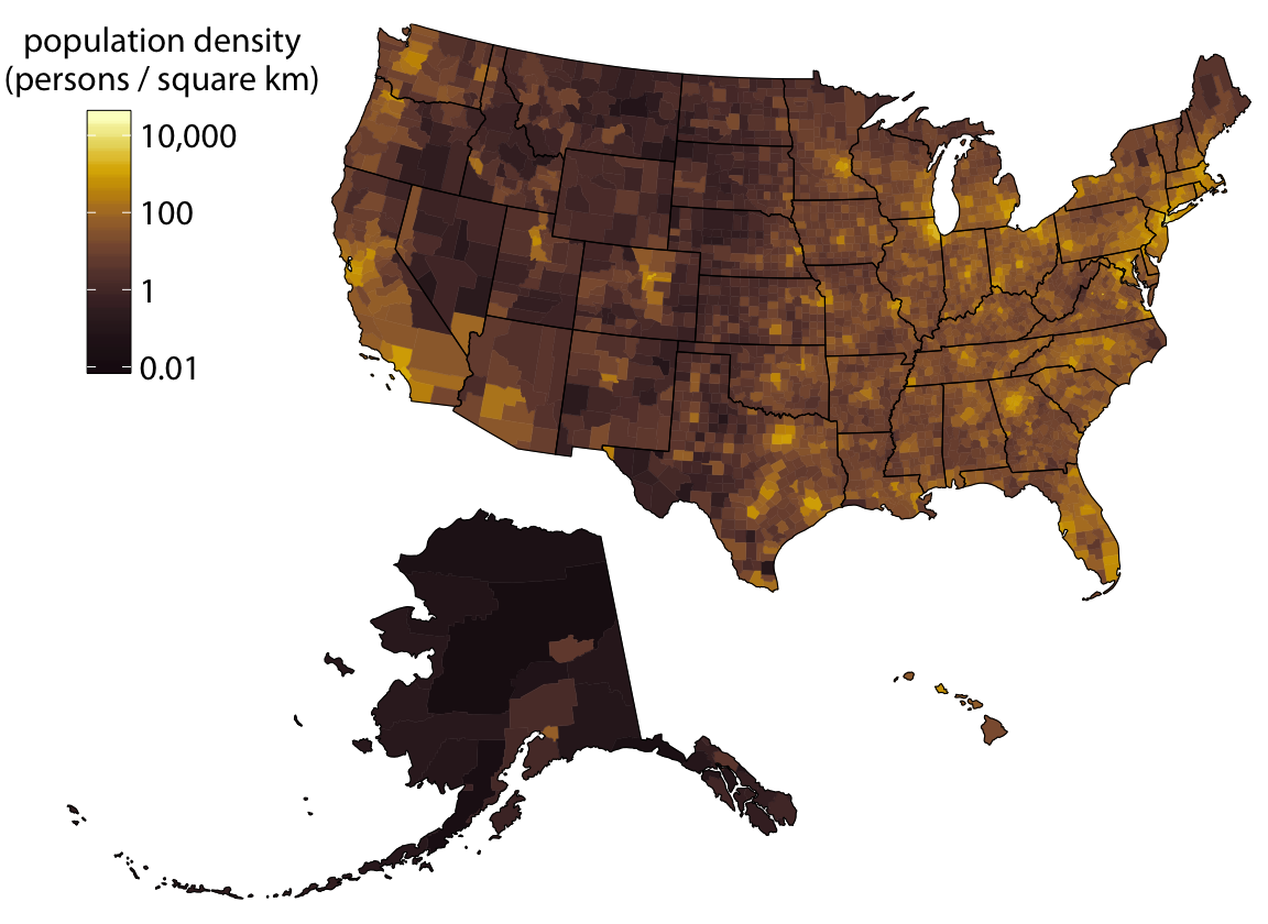
In 2010 the United States recorded an average population density of about 36 people per square kilometer, but that average hides a mosaic of stark differences: some counties are home to over 1,200 people per square kilometer, while others remain below 10. These disparities shape everything from transportation planning to healthcare delivery, making a clear understanding of county-level density essential for policymakers and residents alike.
Current Density Landscape
Today, the distribution of people across the country remains heavily skewed toward a handful of highly urbanized counties. In states such as California, New York, and Illinois, a significant portion of the population lives in densely populated pockets that exert considerable pressure on infrastructure, housing, and environmental resources. Conversely, rural regions in the Midwest and the Mountain West still see densities below 20 people per square kilometer, reflecting lower demand on local services but also presenting challenges in maintaining economic vitality.
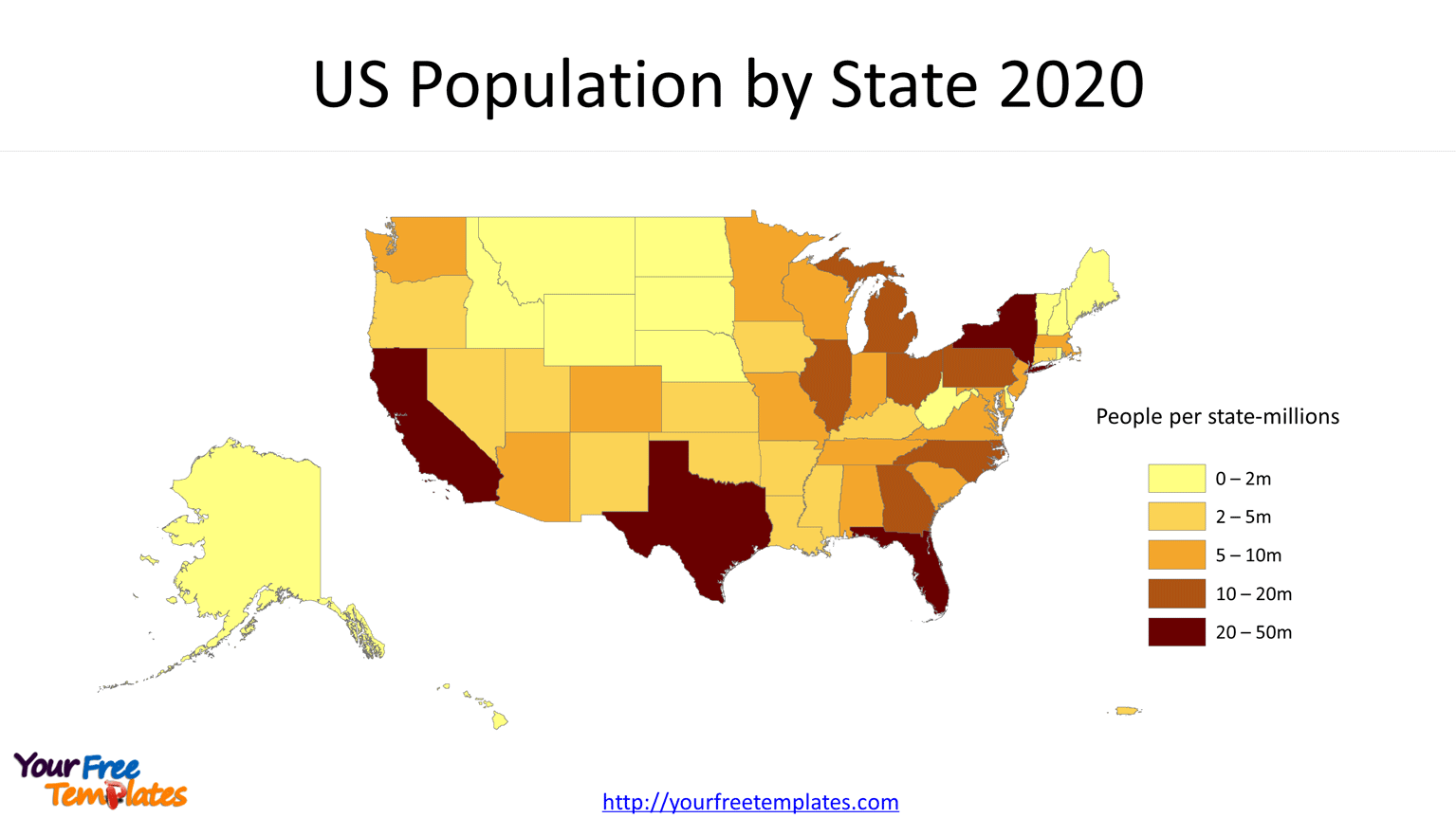
Historical Trends and Shifts
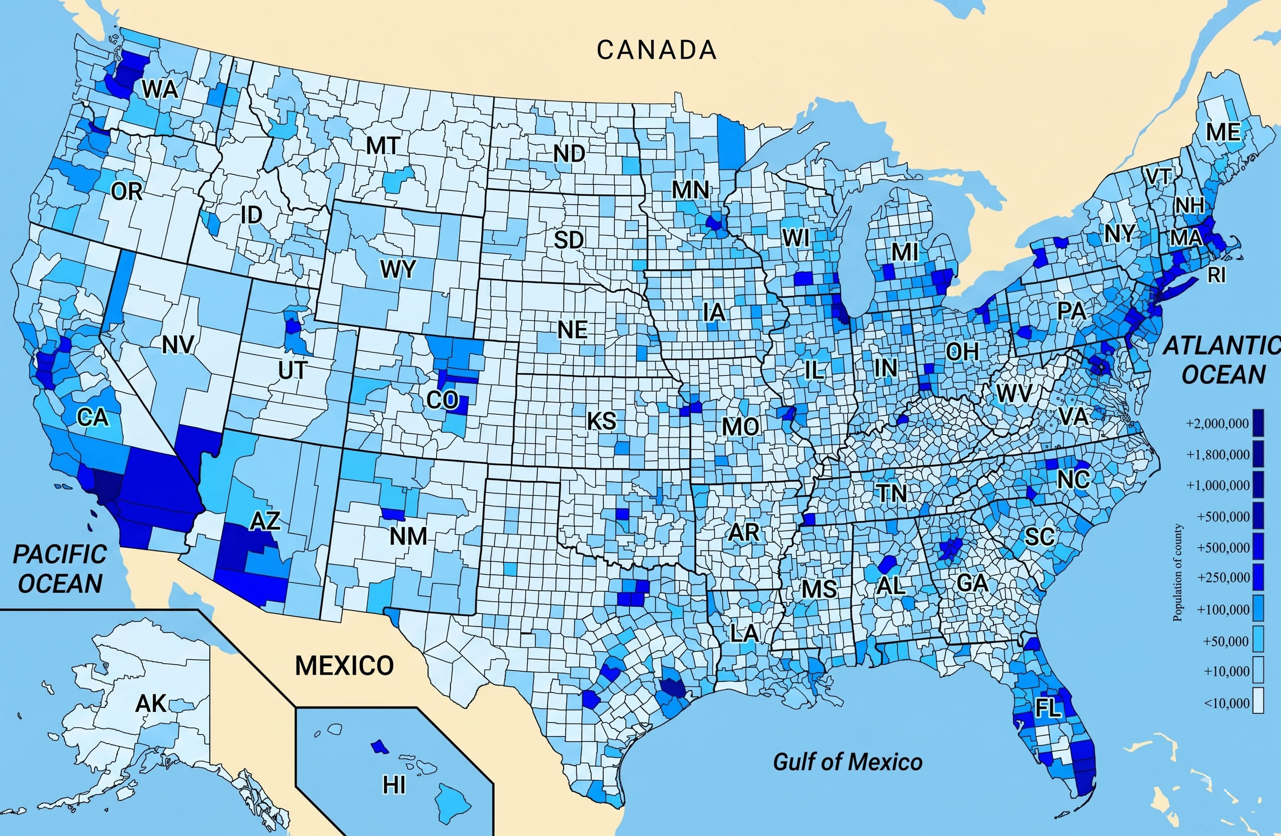
Between 2000 and 2010, the United States experienced a modest overall rise in population density, driven primarily by migration to coastal urban centers and the expansion of suburbs. The map above captures that shift, highlighting the growth of counties surrounding major metropolitan areas. However, the pace of change has slowed in recent years as population growth has become more uneven, with some traditionally dense regions plateauing while others, especially in the Sun Belt, continue to accelerate.

What the Numbers Mean for Communities
Understanding density dynamics is key to effective resource allocation. In densely populated counties, planners prioritize expanding public transit, investing in affordable housing, and mitigating environmental impacts such as air pollution and heat islands. Rural counties, by contrast, often focus on improving broadband access, strengthening local economies, and preserving open space. Moreover, the density profile influences electoral politics, emergency response times, and the spread of communicable diseases—factors that have become especially relevant in recent public health crises.
As the country moves forward, the interplay between urban growth and rural resilience will continue to shape the socioeconomic fabric of the United States. Policymakers and citizens alike must stay informed about these patterns to ensure that development strategies meet the diverse needs of all regions while promoting sustainable, inclusive growth.
U.S. Population Density Map | Map, United States Map, Human Geography

U.S. Population Density Map | Map, United states map, Human geography
There's This Concept Called Population Density : R/TheRightCantMeme

There's This Concept Called Population Density : r/TheRightCantMeme
USA States Population Density Map PPT Presentation

USA States Population Density Map PPT Presentation
US Population Density Map - Guide Of The World

US Population Density Map - Guide of the World
Us Population Density 2024

Us Population Density 2024
Us Population Density Km2 – Population Density By Country 2022 – JULAL

Us Population Density Km2 – Population Density By Country 2022 – JULAL
2020 Population Density Chart : World Population Density Interactive

2020 Population Density Chart : World Population Density Interactive ...
United States Population Density Map - People Per Km² | World Atlas

United States Population Density Map - People per km² | World Atlas
United States Population Density Map

United States Population Density Map
Population Density In The United States By State [OC] : R/MapPorn

Population density in the United States by state [OC] : r/MapPorn
United States Population Density Map
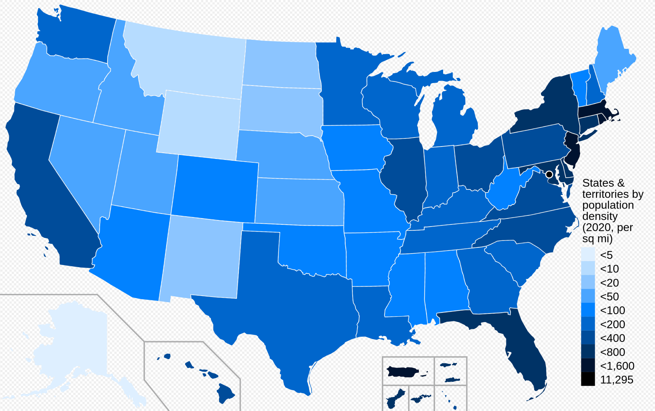
United States Population Density Map
United States Population Density Map

United States Population Density Map
United States Population Density Map - All For One

United States Population Density Map - All For One
Population Density Map Of USA 2025

Population Density Map of USA 2025
Us Population Density Km2 : Population Density United States Of America
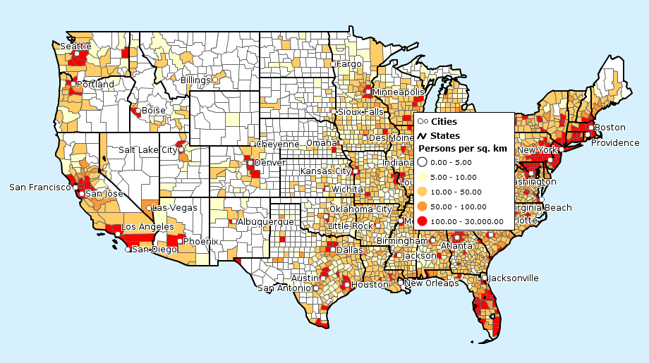
Us Population Density Km2 : Population Density United States Of America ...
Us Population Density Map 2016 - Mettolf

Us population density map 2016 - mettolf
Population Density Us Interactive Map - Mensmanager

Population density us interactive map - mensmanager
Us Map Population Density Capturing The Size And Density Of New York

Us Map Population Density Capturing The Size And Density Of New York
Us Map By Population Density

Us Map By Population Density
Population Density Map Of USA 2025
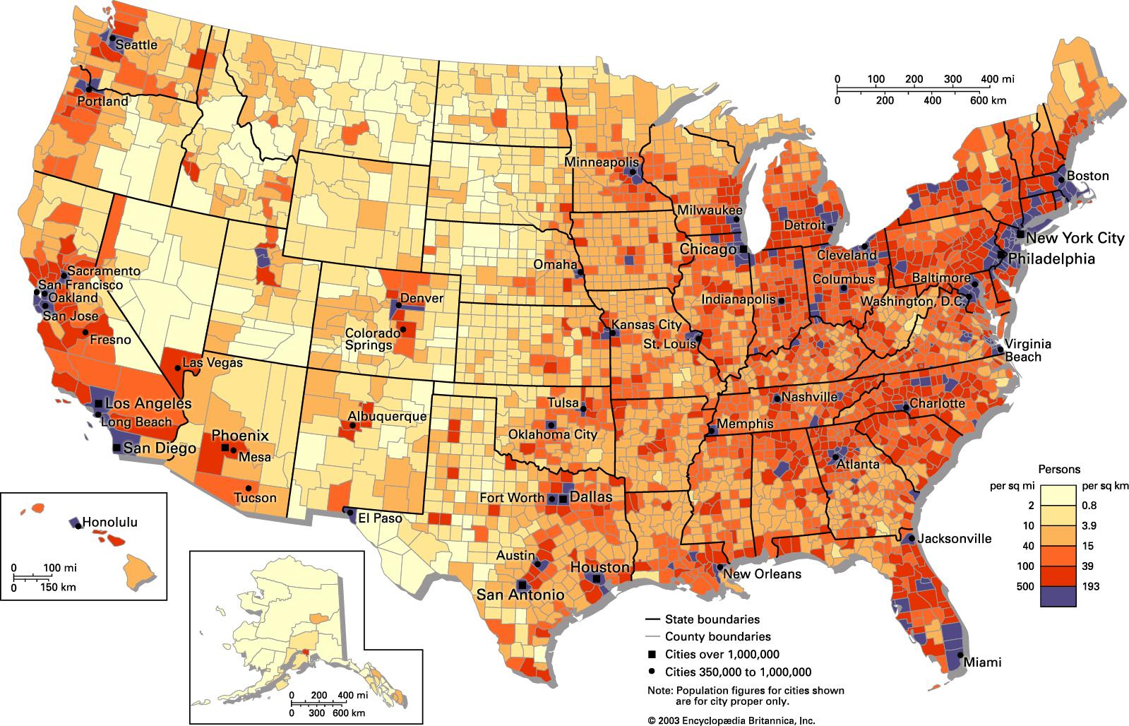
Population Density Map of USA 2025
Population Of USA Map Density | Printable Map Of USA

Population Of USA Map Density | Printable Map Of USA
Us Population Density Wall Map Thematic - Mensbody
Us population density wall map thematic - mensbody
Map Of Population Density Usa | United States By Density 2024 – HXDM

Map Of Population Density Usa | United States by Density 2024 – HXDM
United States Population Density Map

United States Population Density Map
US Population Density Map - Guide Of The World
US Population Density Map - Guide of the World
US Population Density Map - Guide Of The World
US Population Density Map - Guide of the World
US Population Density Map

US Population Density Map
Population Density Map Of US

Population Density Map of US
Us Population Density Km2 : Population Density United States Of America

Us Population Density Km2 : Population Density United States Of America ...
